

Welcome to Week 38 of my Genealogy challenge, from the wonderful Amy Johnson Crow, of writing something about your Ancestors for a whole year, #52Ancestors in 52 weeks. This week’s prompt is ‘On The Map’.
This Week I just wanted to mention the value of The Tithe Maps and how much they can help you bridge the gap between the Parish Registers, the start of the recognised Census Returns and the start of Civil Registration in the UK.
As we know, standardised Civil Registration started in England and Wales in 1837 and was governed by the Births and Deaths Registration Act of 1836, prior to this, the only way to trace an Ancestor’s life was via Parish Registers. The first national Census took place in 1841, but this only listed the basic information and sadly at this time, no addresses were listed, just whether they were born in the County they were enumerated in. So finding an address or precise location for an Ancestor at this time is difficult, enter The Tithe Act of 1836!
The Tithe Commission was set up to value individual pieces of land that were then liable for a payment called a ‘Tithe’. The lands valued are largely rural, so large urban areas are not covered by the Tithe Act. More specific information regarding the Tithe Act can be found Here
So what can we as Genealogist’s hope to find there?
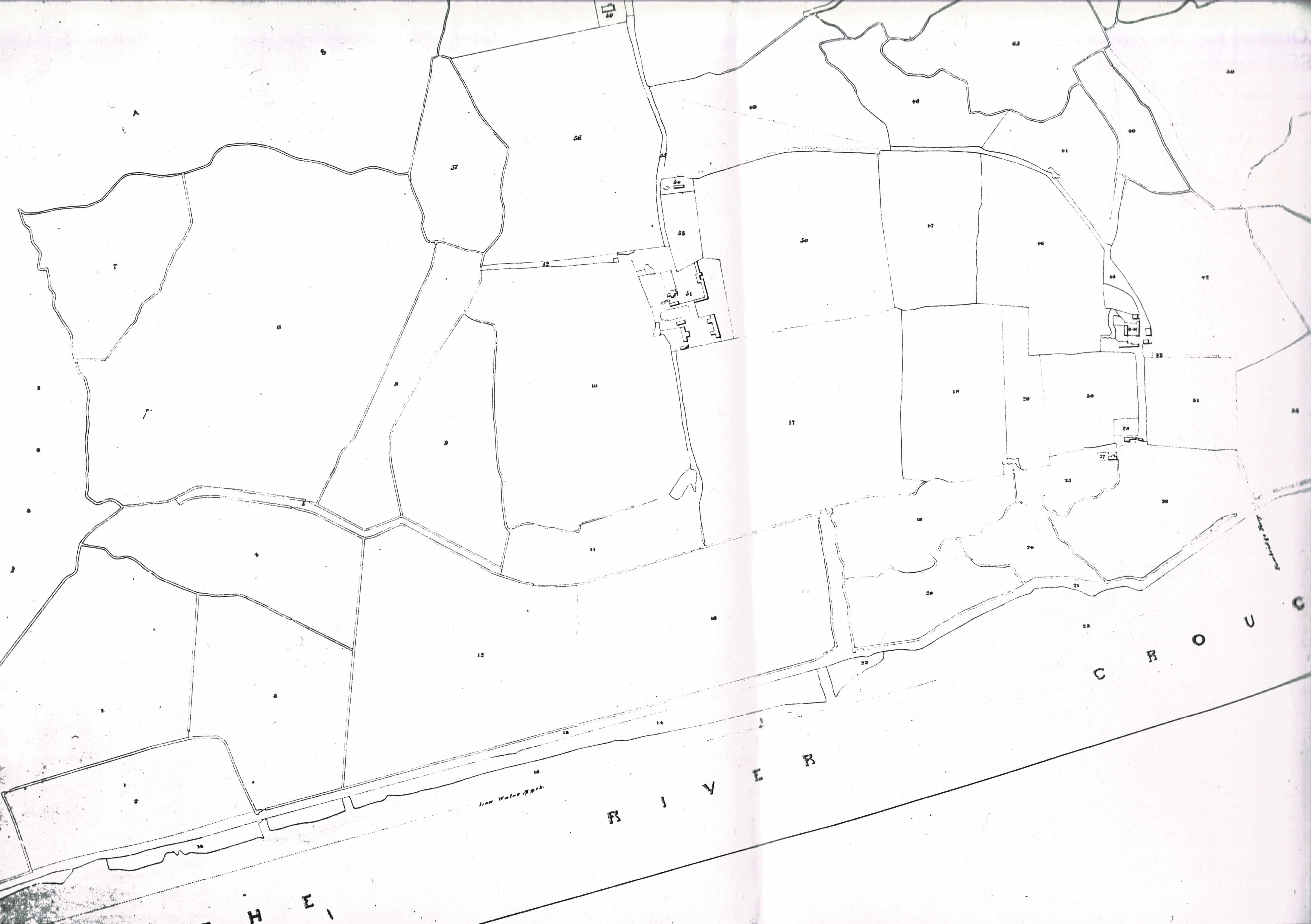
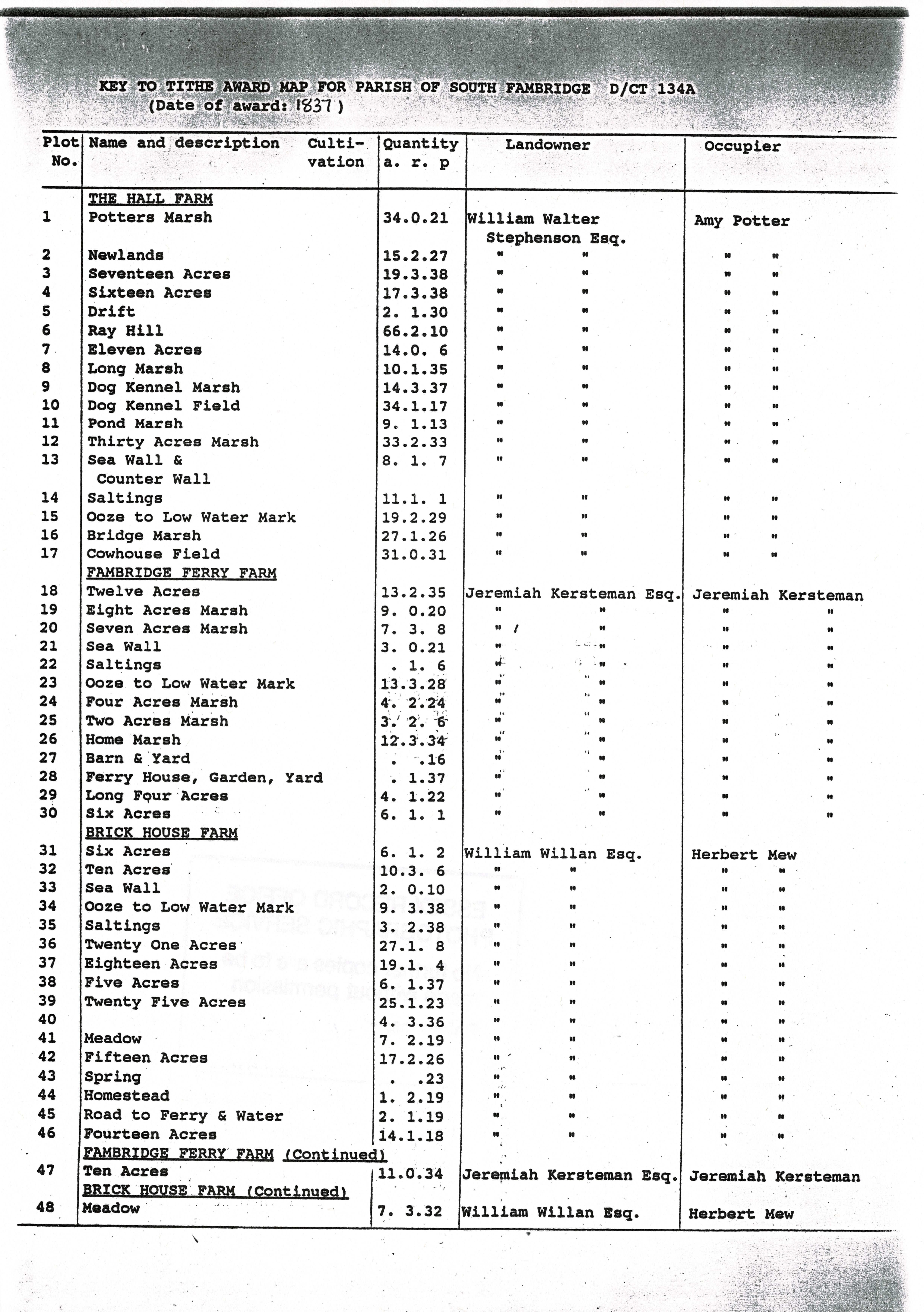
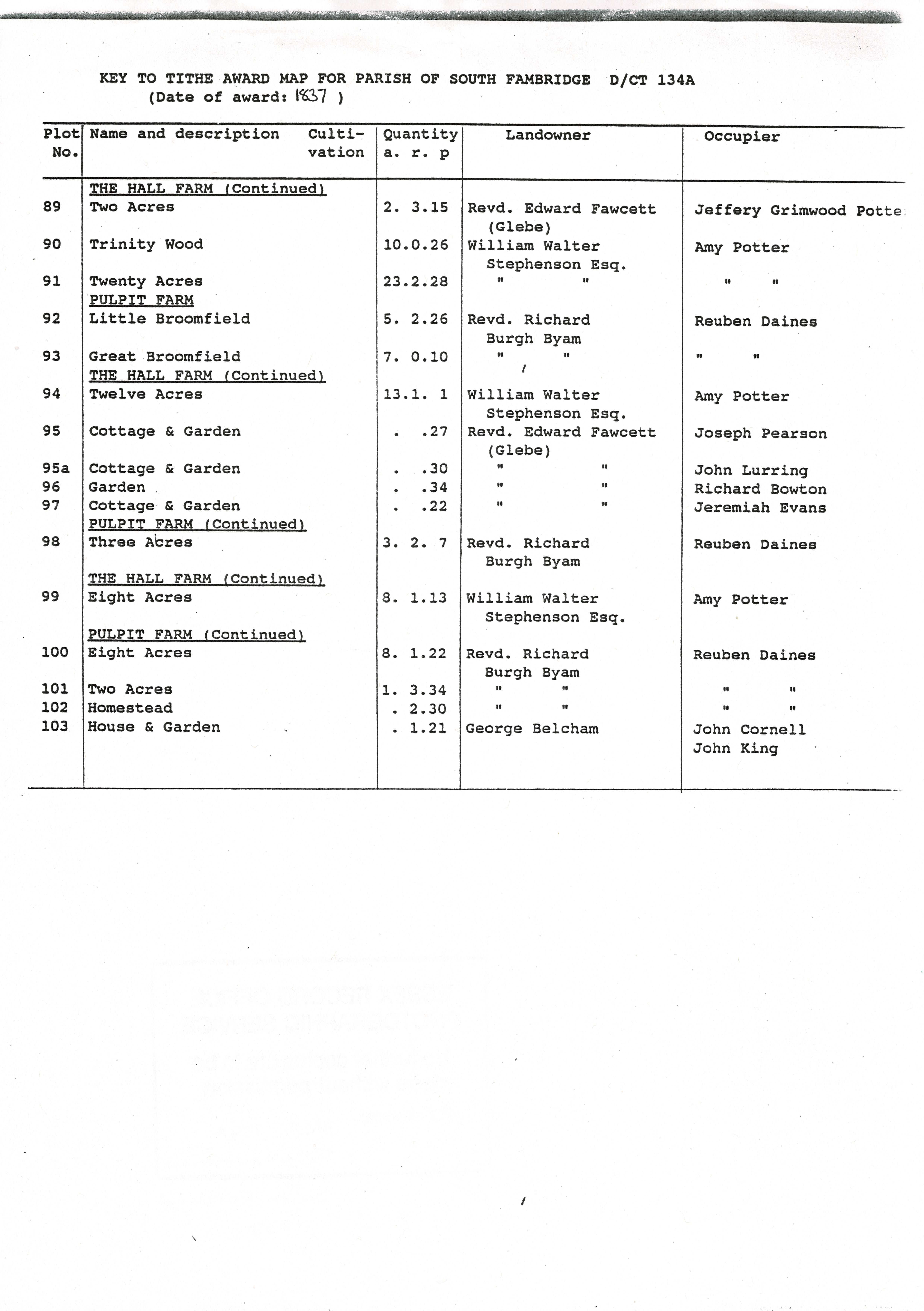
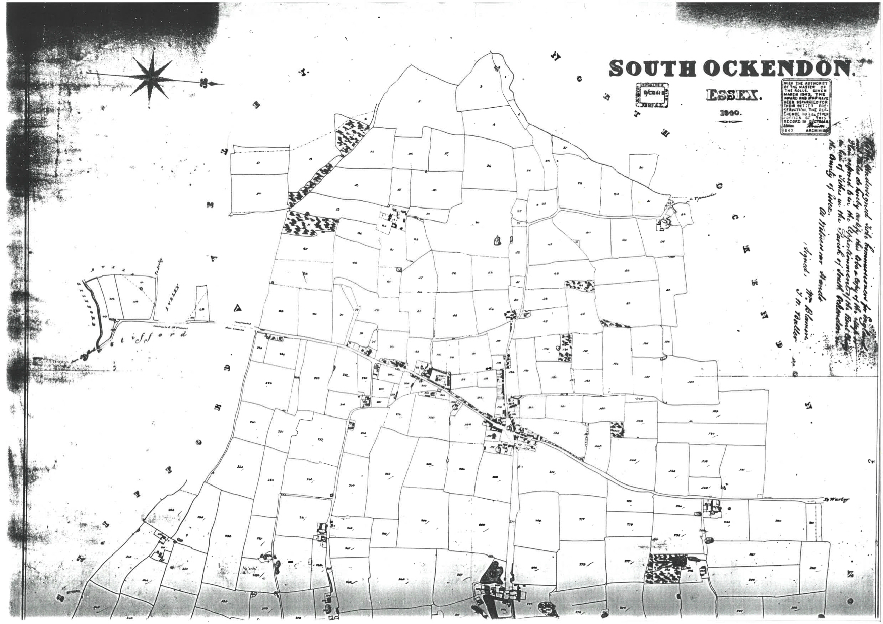
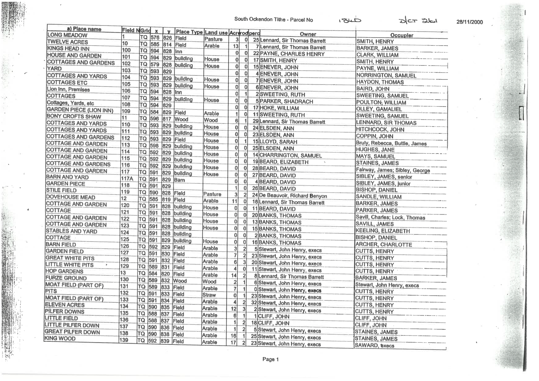
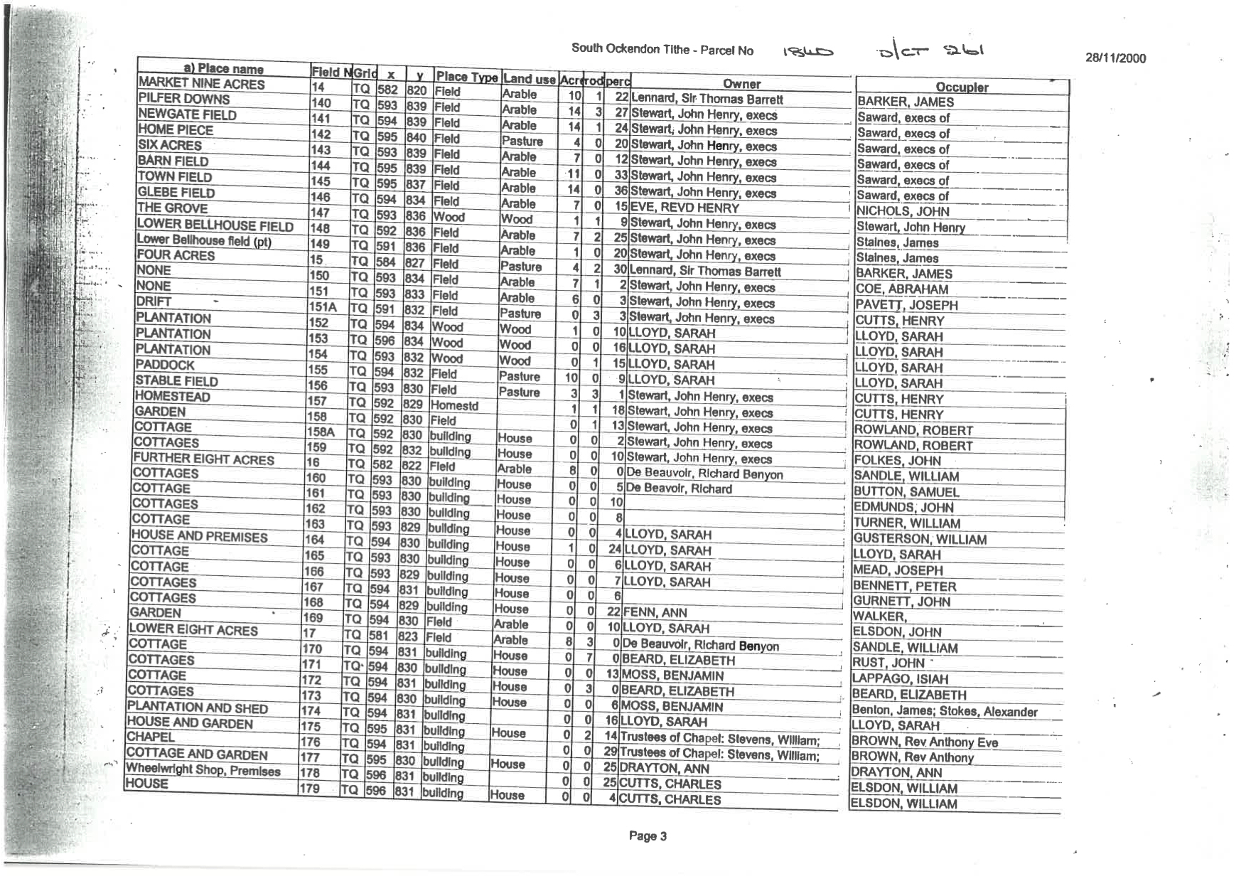
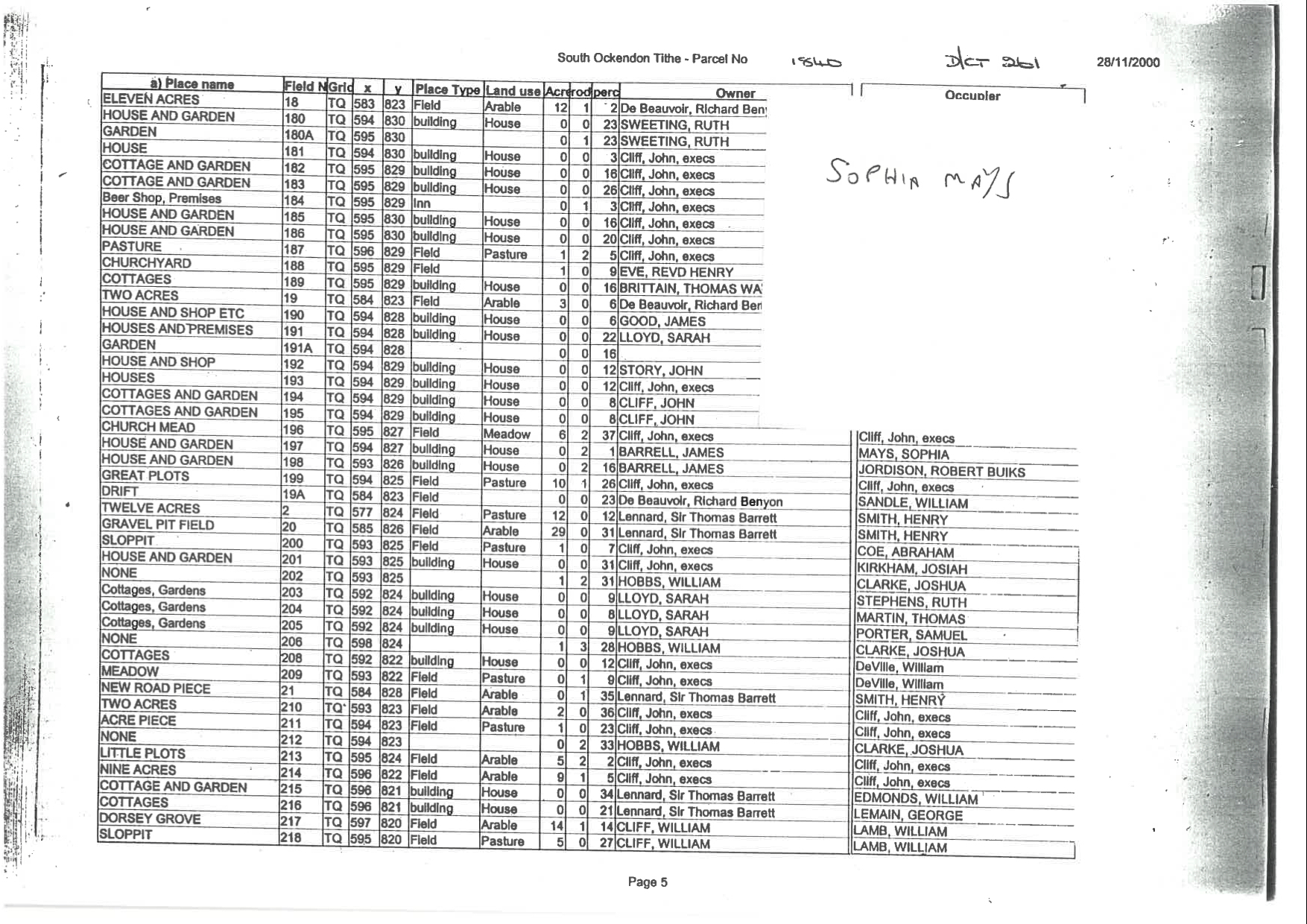
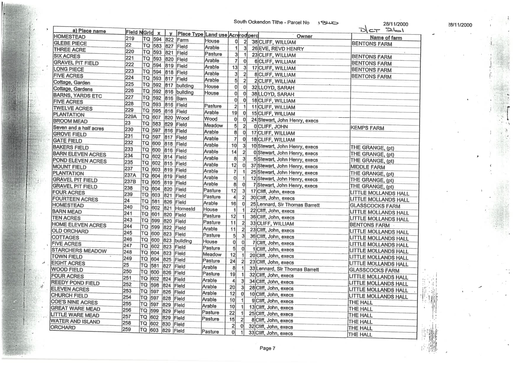
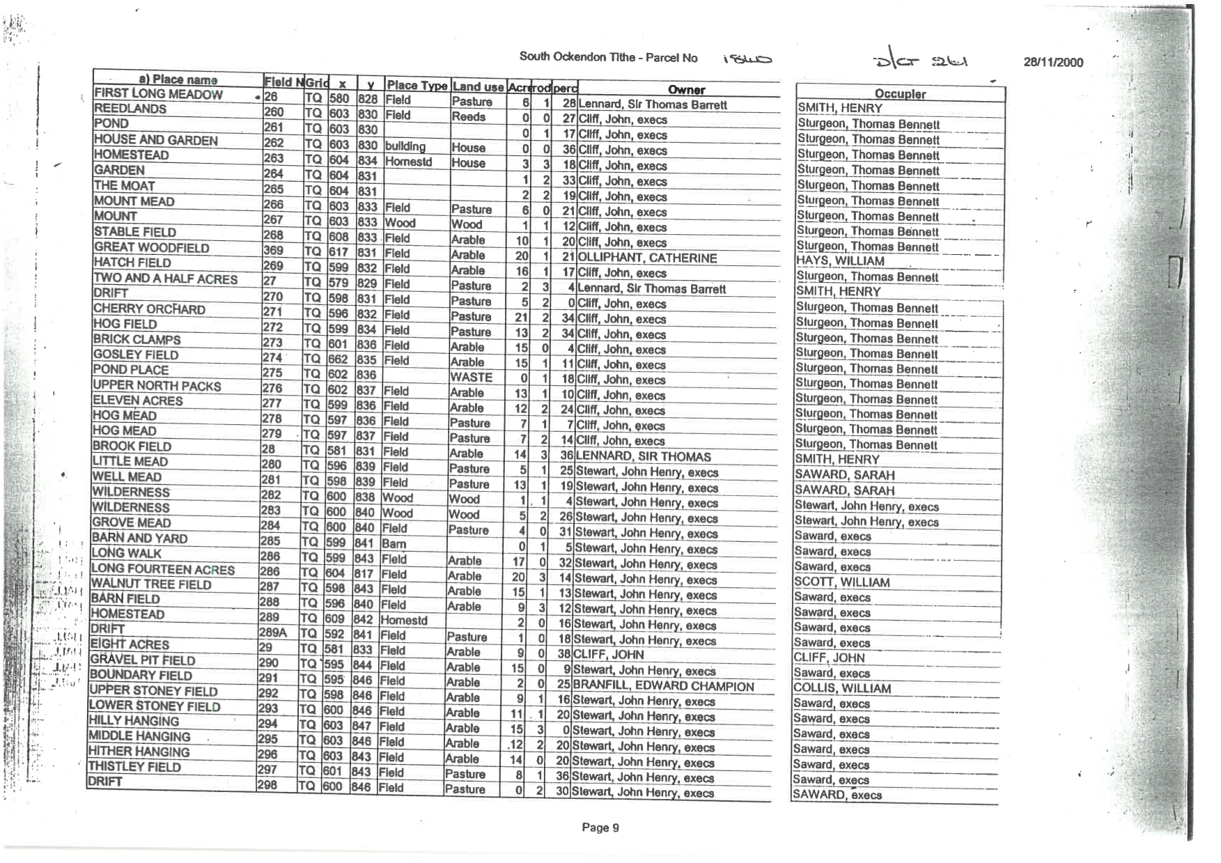
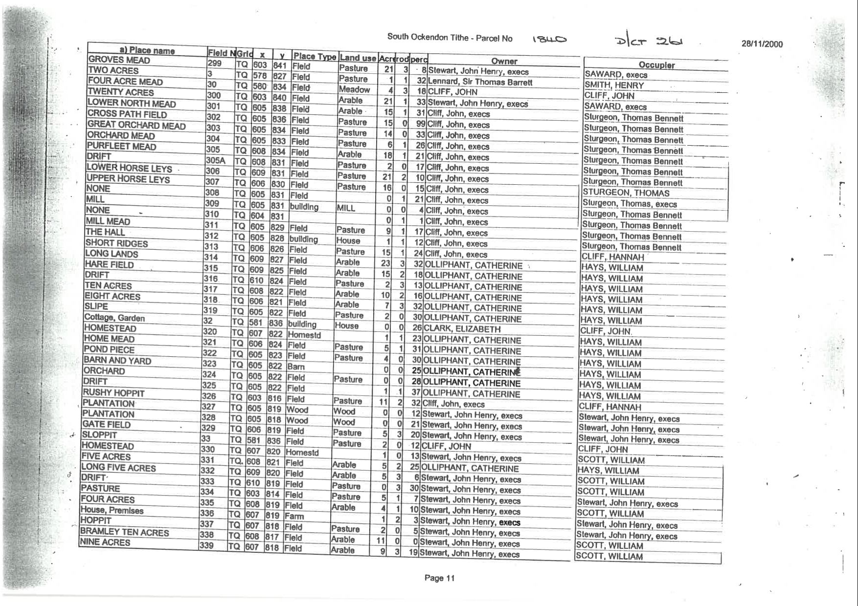
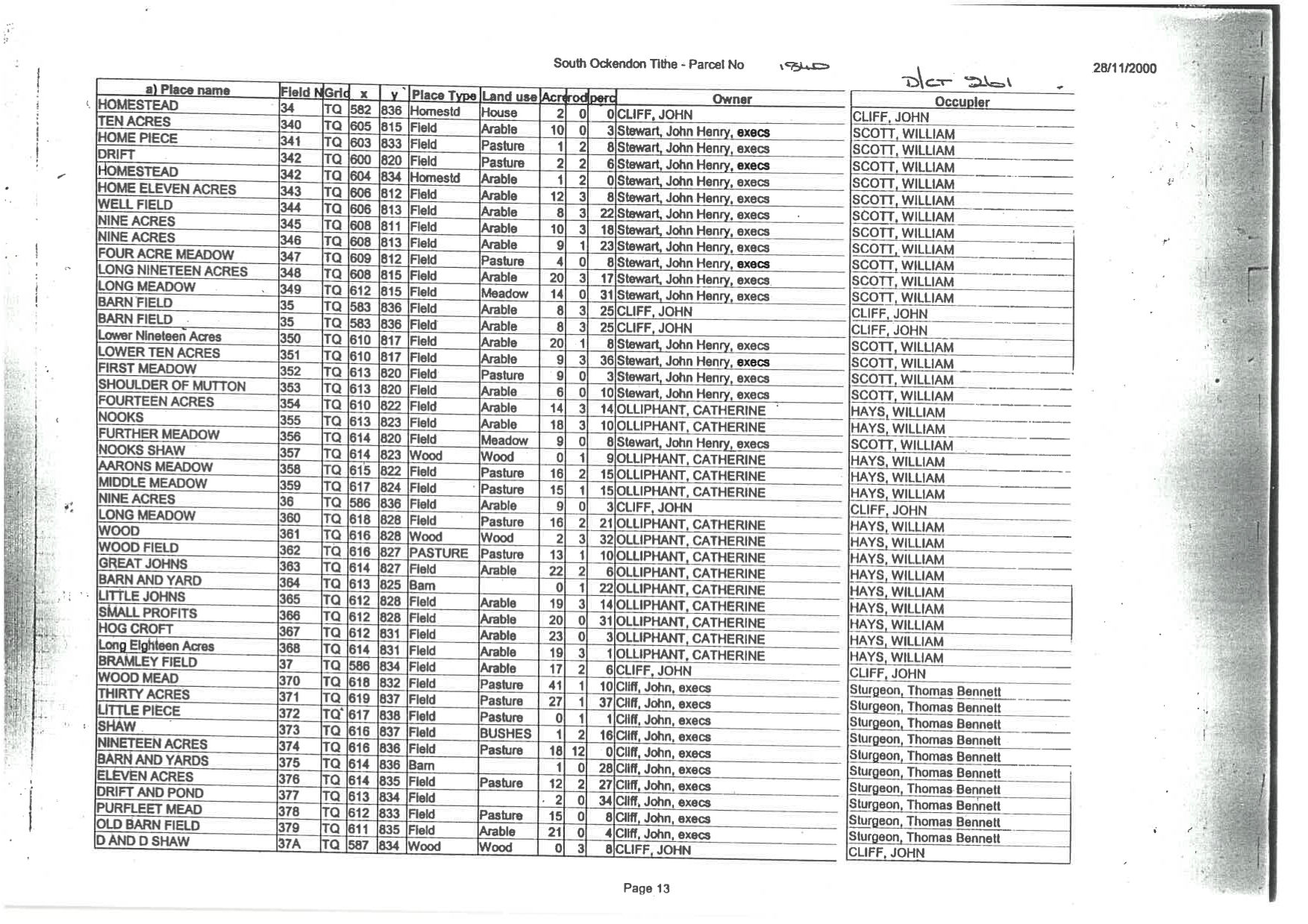
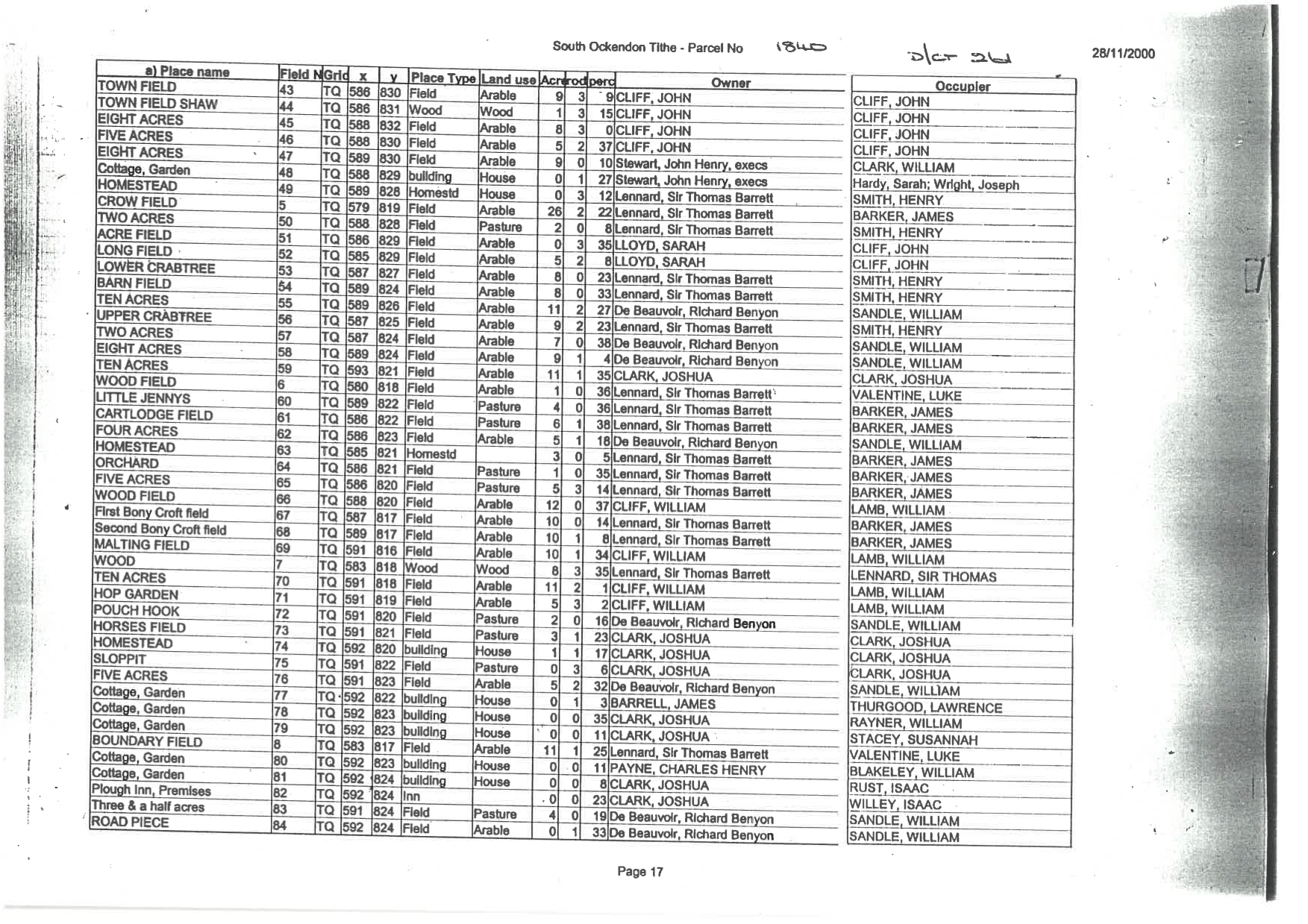
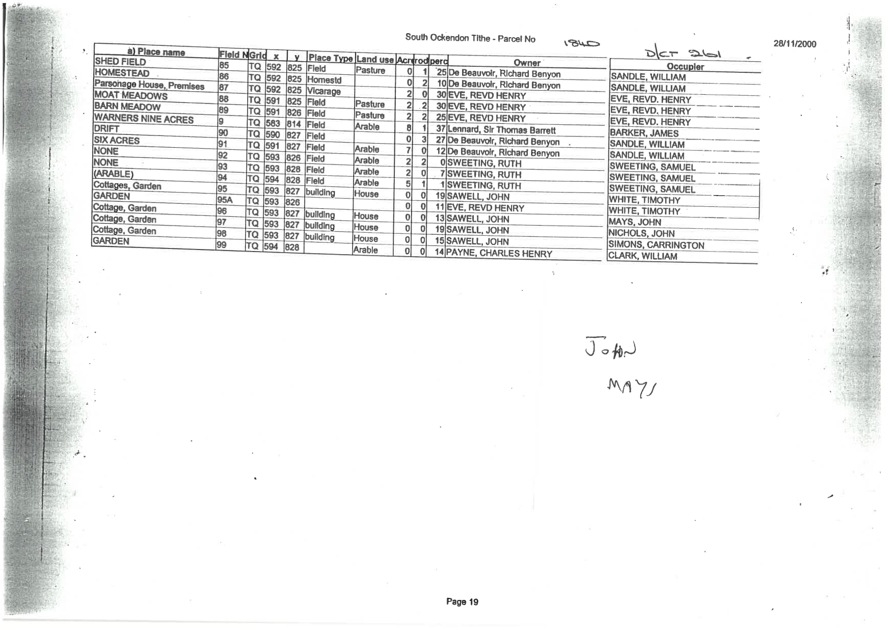
Details of each piece of land were entered on pre-printed schedules, known as apportionments, and these were arranged by parish. They record the names of the various landowners, the occupiers or tenants, the name or description of the land or property, the state of cultivation (i.e. arable, pasture, meadow, wood etc.), the area (in acres, rods and perches) and the value assessed. Each piece of land or property also has a number attached to it which acts as a cross-reference to the associated map and on each Map, every building is recorded, with the boundaries of the various pieces of land clearly marked. Rivers, bridges, lakes, ponds and other significant features are also shown. So assuming your Ancestor was a Farmer, Land Owner, or a simple Agricultural Labourer, the chances are, you might find a mention of him here.
Over the years I have managed to collect a large number of Tithe Maps and apportionments for my home County of Essex, including parishes of South Fambridge, North Fambridge, South ockendon, North Ockendon, Prittlewell and Ashingdon. Each with a mixture of mentions of my direct Ancestors. So if you have never heard of them before, I suggest having a read up online and making the most of a really valuable resource.
Below are the Tithe Maps for South Fambridge

Below are the Tithe apportionments for South Fambridge

Below are the Tithe Maps for South Ockendon

Below are the Tithe apportionments for South Ockendon

Tithe Maps kindly published with permission of The Essex Record Office
I spend a lot of time researching and sharing these family connections, so if this post helped you uncover part of your family story, you can support my ongoing research here:


I would absolutely love to find out more about our family heritage but sadly very little records are available, we could be of Scottish, Franco, Anglo Saxon descent… 🤔
LikeLiked by 1 person
or maybe all of the above! Have you taken a DNA test Daniel??
LikeLike
Most interesting Paul, Tithe Apportionments are new to me (except Irish GRIFFITHS apportionments). Where will i find them?
LikeLiked by 1 person
The Genealogist website is the only website that has access to them, but the local record office in the area that you are looking, will definitely have them.
LikeLike
One thing I found very difficult when researching my Welsh ancestry, was the spelling of names…each area seemed to spell the same name differently. And recording births might not take place for a year or more…it was a very difficult process, but I think I pieced it all together, eventually.
LikeLiked by 1 person
A lot of similar sounding names and place names does make it difficult to follow an ancestor, you need maybe an unusual occupation or wife’s name to help sort them out!
LikeLiked by 1 person